Previously, until the bridge of Senzujoshi was built for crossing to the other bank of the Sumidagawa River, it was possible to get to the island of Mukojima, using the
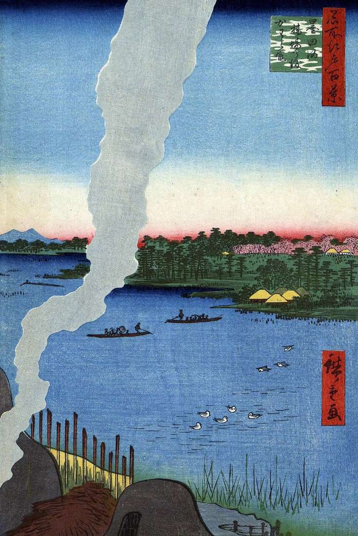
Previously, until the bridge of Senzujoshi was built for crossing to the other bank of the Sumidagawa River, it was possible to get to the island of Mukojima, using the
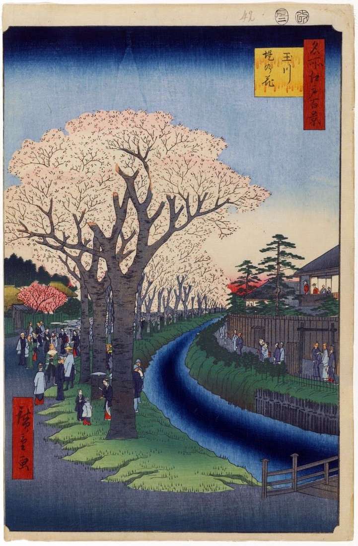
Hiroshige portrayed the western outskirts of the capital, the Shinjuku district and the Tamakawa thirty-kilometer canal, which was built to supply Edo with drinking water. In this engraving is shown
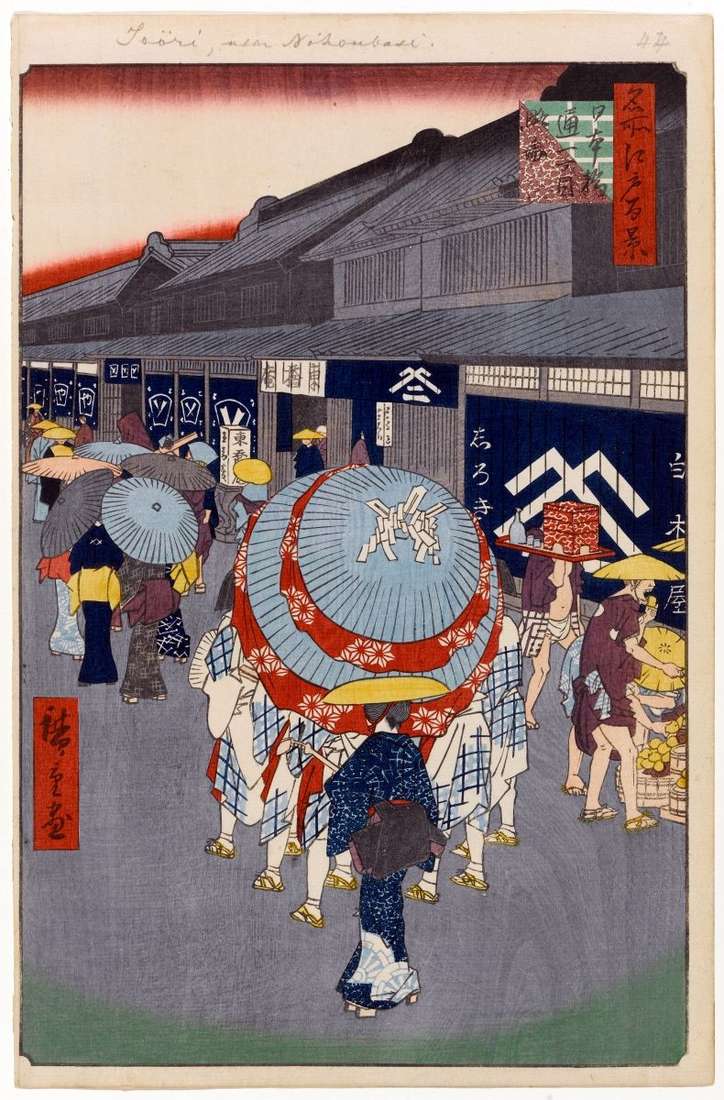
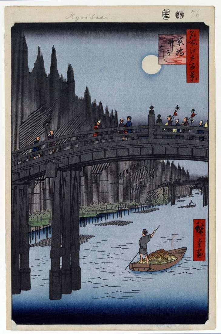
The Nihonbashi quarter was located around the Nihonbashi bridge. Here there were dwellings and shops of the most successful Edo merchant class, for example, the trading houses of the houses
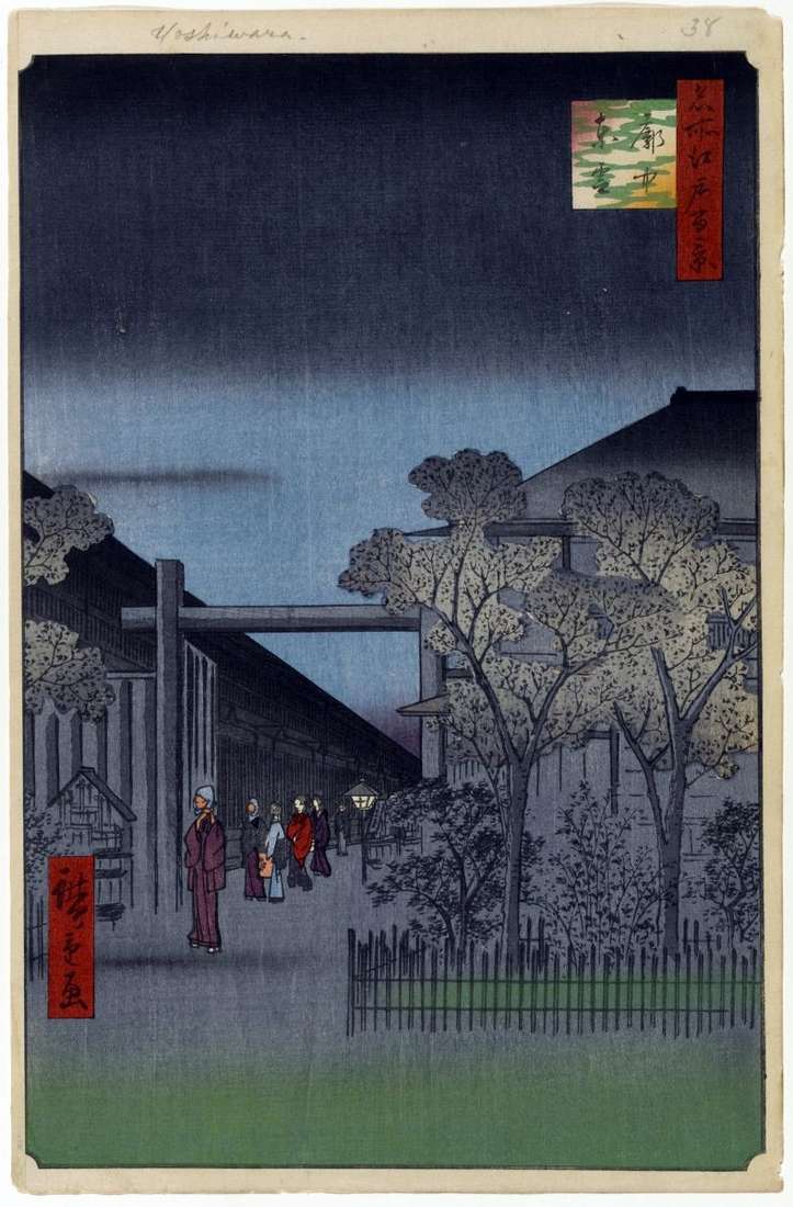
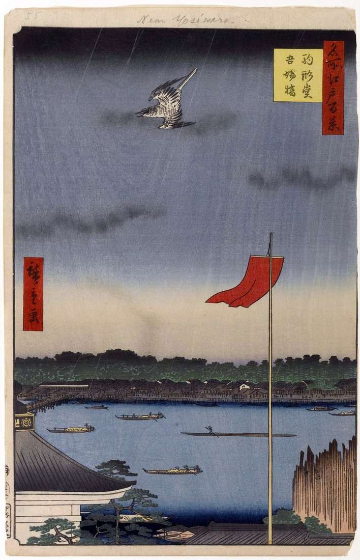
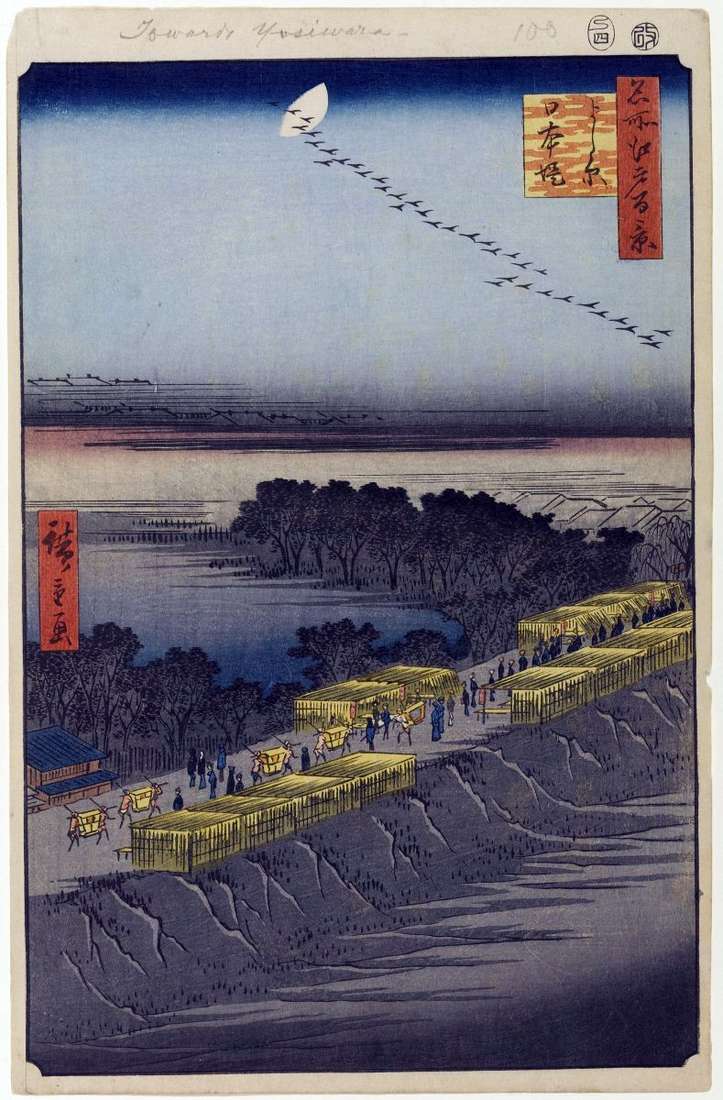
The quarter where the brothels were located, was founded in 1617 and was called Esivara, which literally means “Cane Field”. But soon the original hieroglyphs were replaced with exactly the
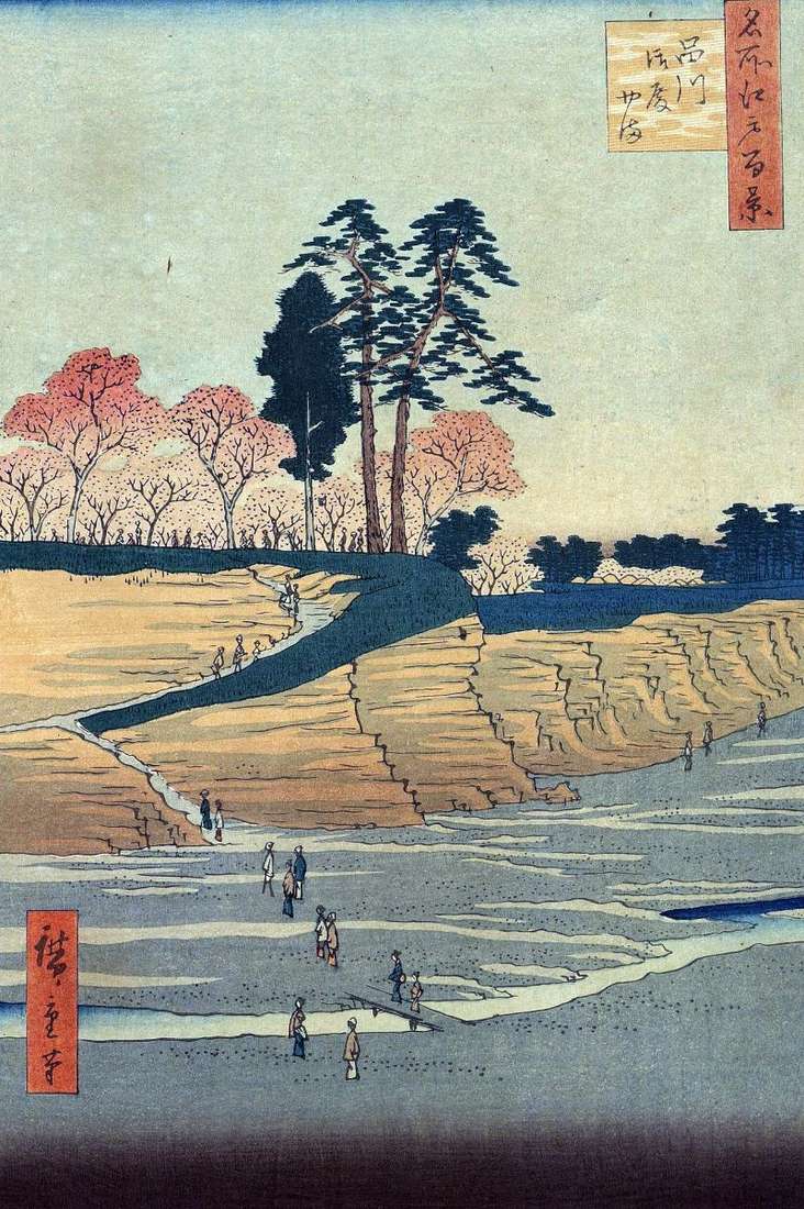
Shinagawa was the first station of the Tokaido road. The Nihonbashi bridge was considered the beginning of the path, the reference point of the distance, but for travelers traveling to
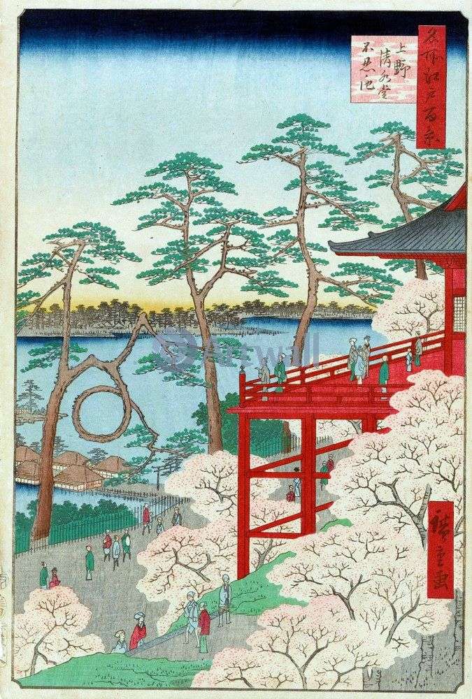
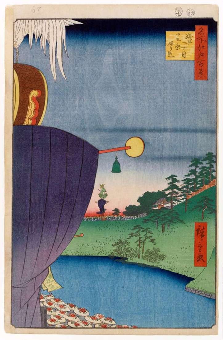
Monastery Kaneydzi was one of the main Buddhist centers of Edo, and Kiyomizudo was one of the main temples of this monastery. The name of the monastery – “Kanayiji” –
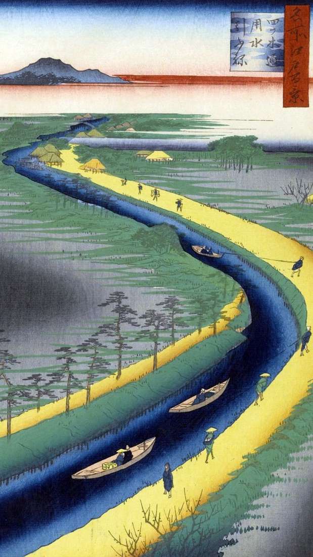
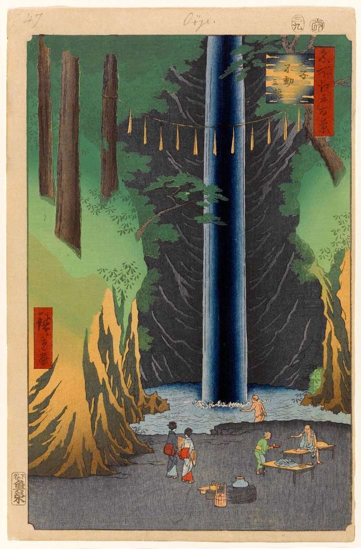
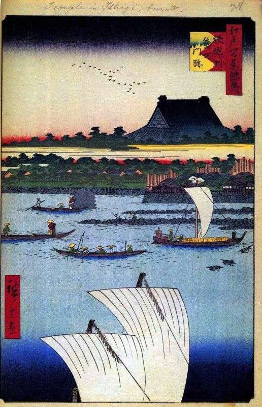
The Etsugi canal was built in the early 17th century to provide drinking water to the Khondze and Fukagawa areas. The source was in Kawarasone Tamai on the Moto-arakawa river.
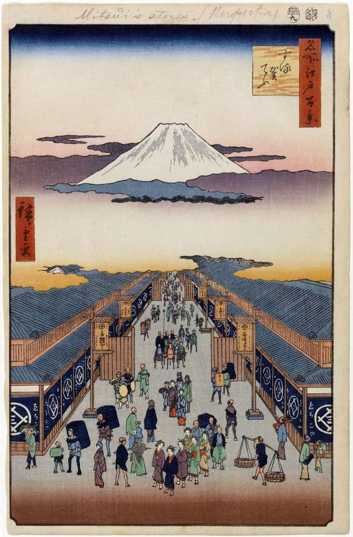
From the Surugate quarter, located near Nihonbashi, a magnificent view of Mount Fuji and the castle of Shogun was opened. This place was very popular among the townspeople. Hiroshige chose
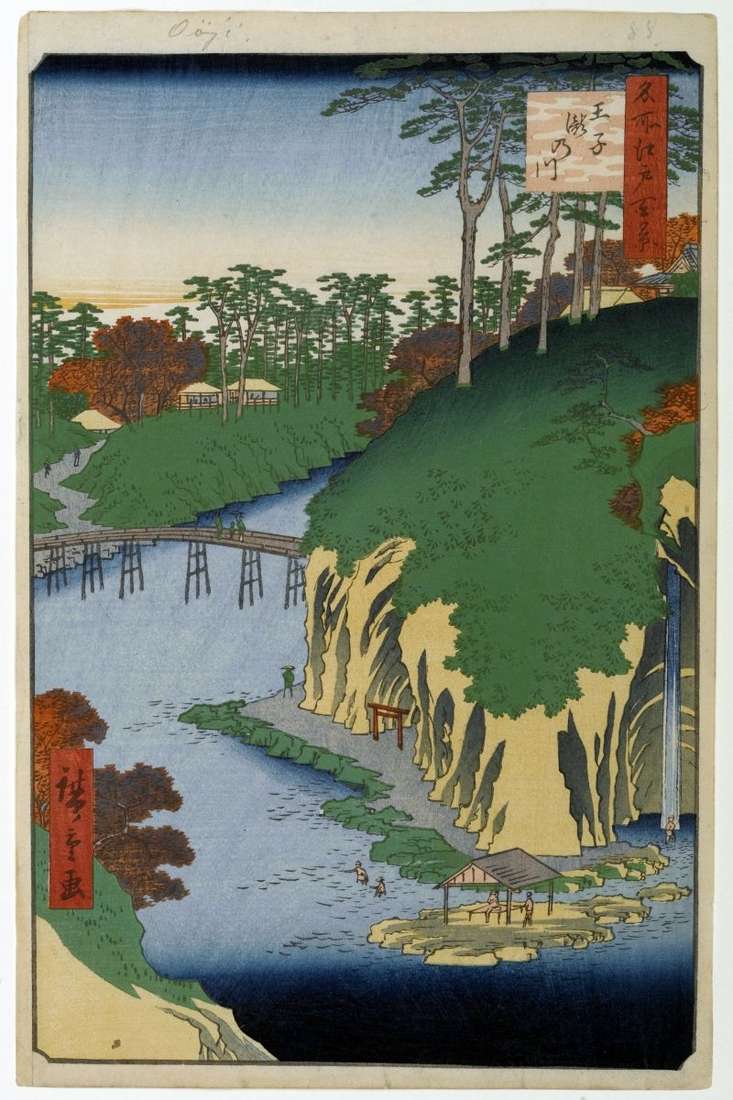
The hill stretching from the mountains of Ueno to Asukayama was crossed by the river Syakudzigawa. The viewer has a view of the part of the river passing through the
The engraving offers a view of the Sumidagawa River from the Komakatado temple, the curved roof of which and the wall, covered with white plaster, occupy the left lower plane
Quay Nihondzutsumi, more precisely a dam, was built by order of Tokugawa Ieyasu in the first half of the XVII century. In its construction took part daimyo all provinces of
The name is due to the fact that earlier there were shops selling malt, yeast, and possibly with the Koji road that used to be here earlier. The festival of
The rise from the Ueno mountains to the Asakusa mountain suddenly breaks off, and from this precipice the river Syakudzigawa flows. Between the two heights a ravine is formed. On
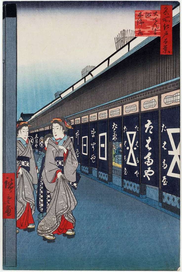
The engraving depicts the street of one of the ancient quarters of Odemmata, which means “The Great Postal Station”. There was a highway Osyukaydo. It was one of the first
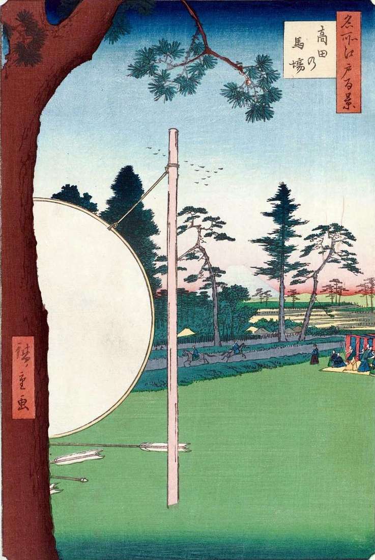
Hiroshige depicts one of the training grounds in the north-western suburb of Edo, built in 1636 by order of the third shogun Iemiju in the territory of the house of
The river Kebasigawa was called the upper course of the Canutebori Canal, which served to pass the vessels towards the Edo Gulf. The bridge over the river Kebasigawa was called
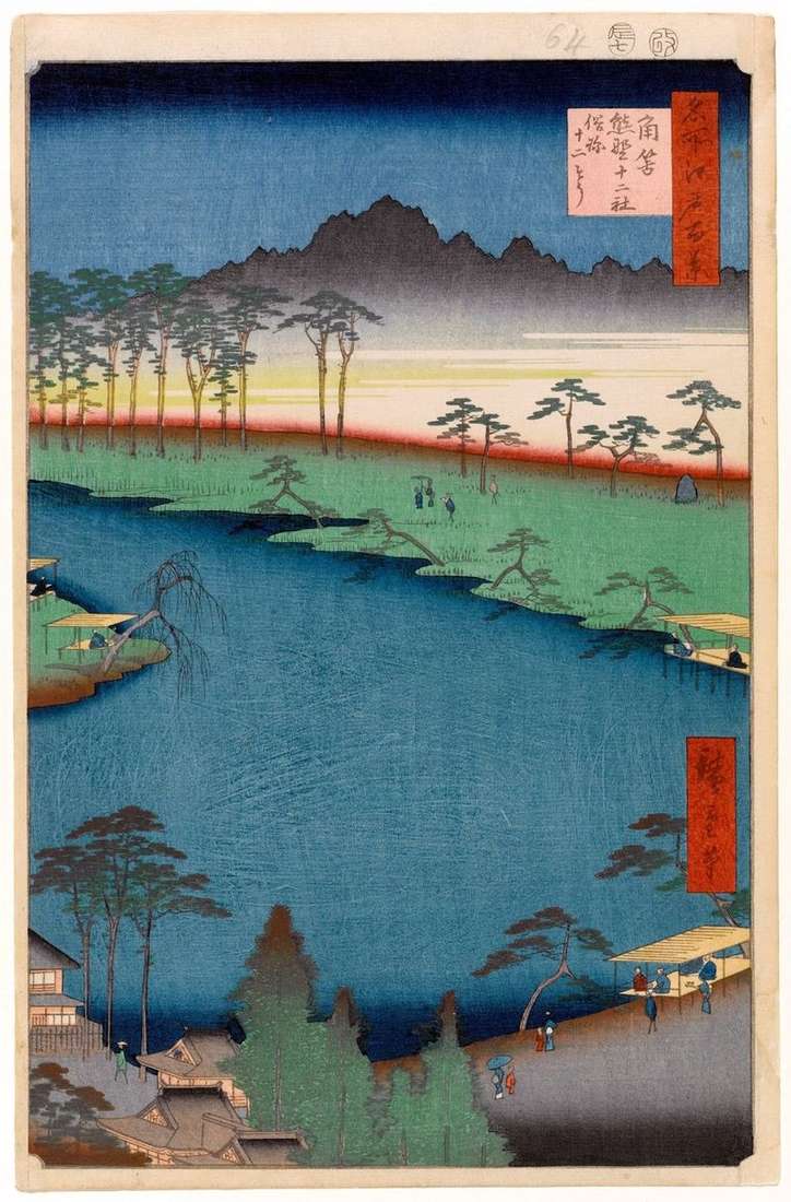
Near the Shintzuku neighborhood of Knight was the village of Tsunohazumura, through which the Koshu-kaido tract, one of the five largest tracts of Japan, passed. But it was especially noteworthy
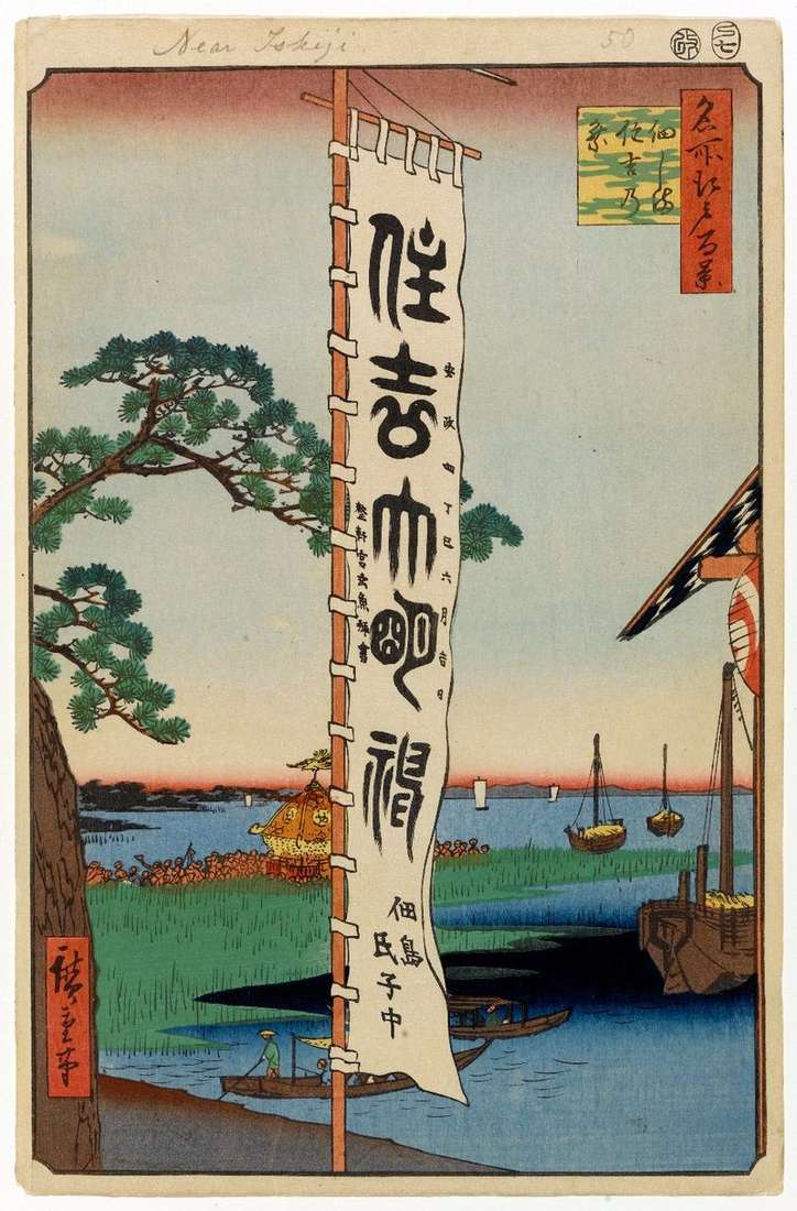
Tsukuda-Zima Island is located at the mouth of the Sumidagawa River. At the beginning of the 17th century, Tokugawa Ieyasu moved a special decree to Edo, thirty-six fishermen – especially
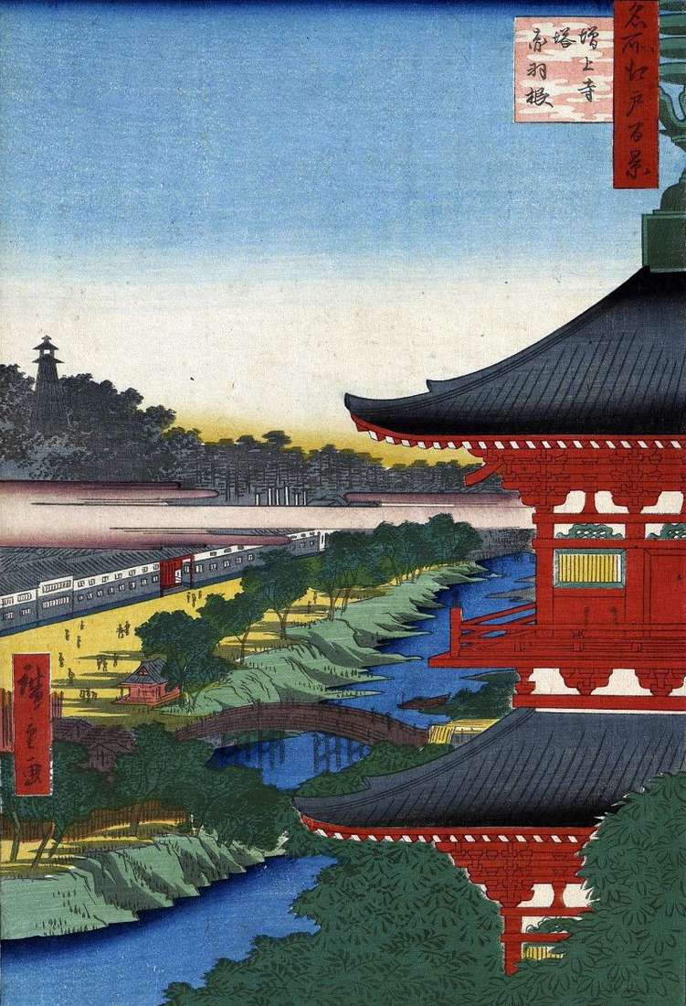
The Dzodzi Monastery was the main temple of the Jodoshu school in Kanto, whose adherents were the Tokugawa house. They buried Tokugawa shogun family members. Kaneiji Temple in Ueno was
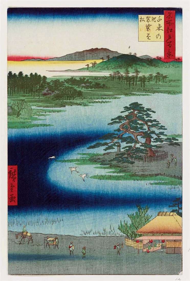
Hiroshige depicts a panorama of the famous pond of Senzoku no Ike, on the right bank of which, in the depths of the grove, there was a Shinto shrine of
On the southern tip of the Teppozu shoal, depicted in the previous engraving, was the Akasit Quarter, where in the Meiji era the government permitted settling the Europeans. The territory