Hiroshige began his series “One hundred views of Edo” from the image of the snow-covered Nihonbashi bridge. The engraving shows the northern, so-called “fish bank”, between the Nihonbashi and Edobashi
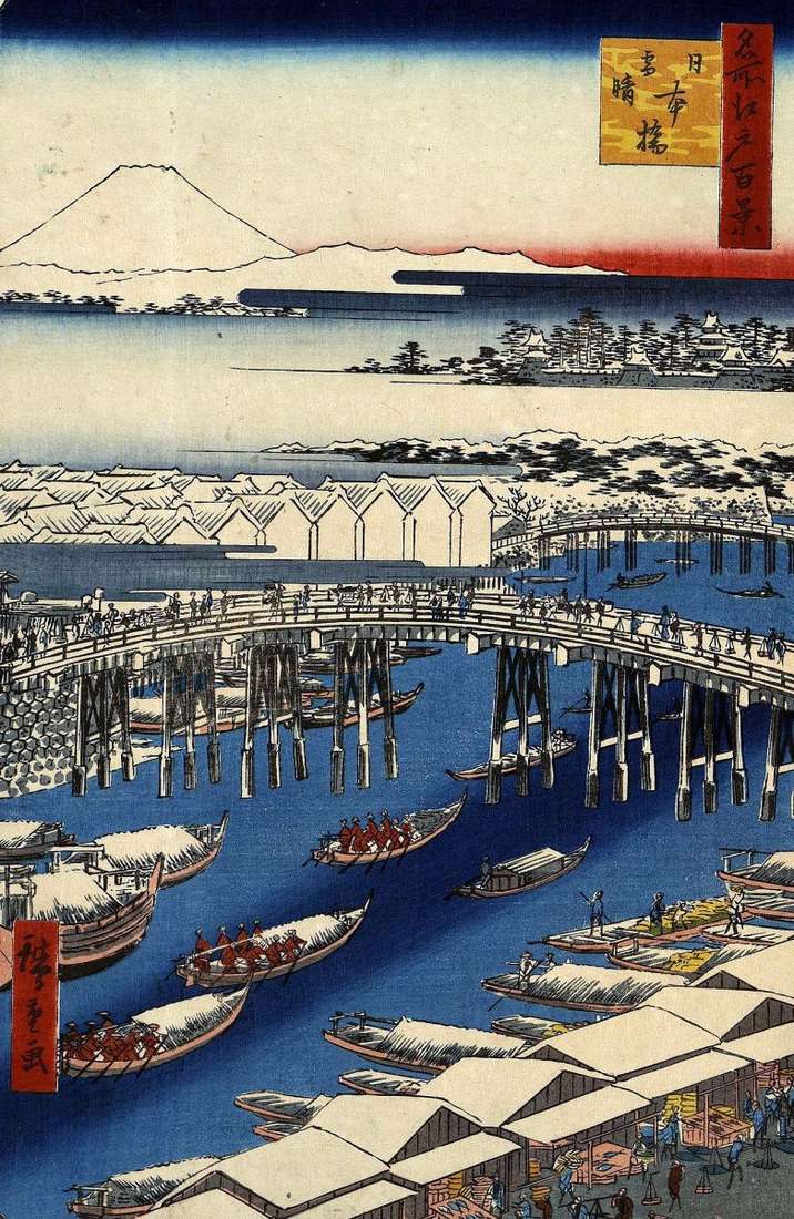
Hiroshige began his series “One hundred views of Edo” from the image of the snow-covered Nihonbashi bridge. The engraving shows the northern, so-called “fish bank”, between the Nihonbashi and Edobashi
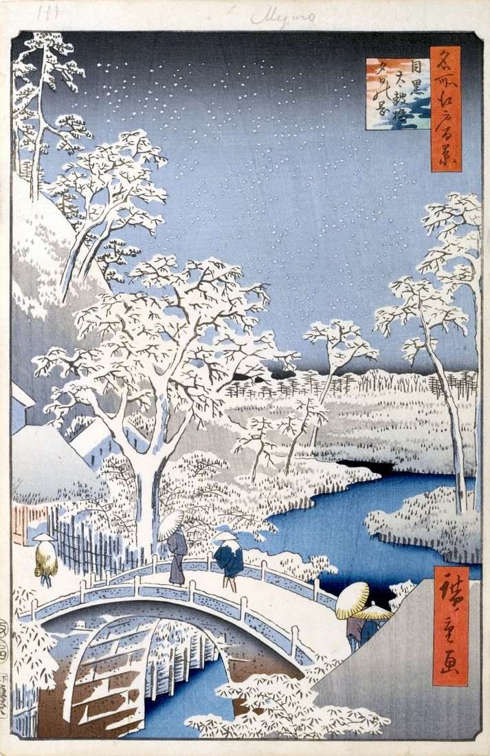
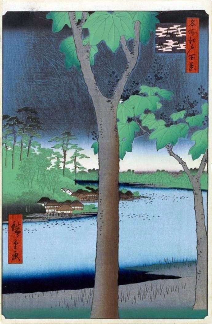
At the slope of Geninzak in Maguro was a stone bridge across the river Megurogava. The image of this bridge occupies the entire foreground of the engraving. The official name
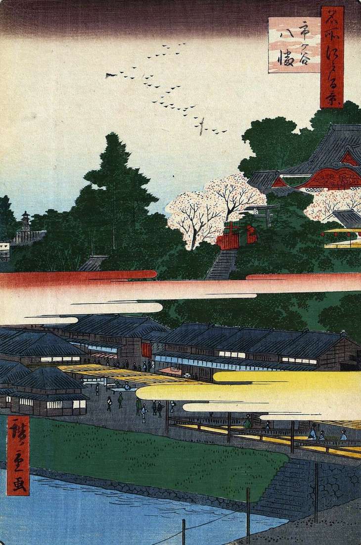
In the foreground there is a part of the bridge at the gate of Itigaya. The name Ichigaya means literally “Market Valley”. Behind the bridge to the left were the
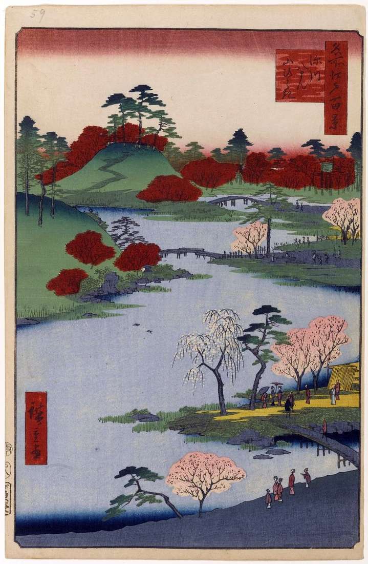
At the northwestern foot of Sannodahti hill from the gates of Akasaka Gomon to the gate of Toranomon was a narrow pond of Tamayke, in the form of a pumpkin
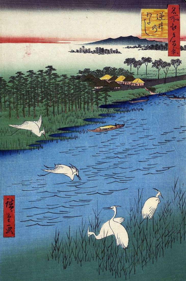
The Sakurakaido tract led into the Simousa-no kuni sakura area, the path traditionally began from the Nihonbashi bridge in Edo. Further, it passed through the Khondze area, along the Tategava
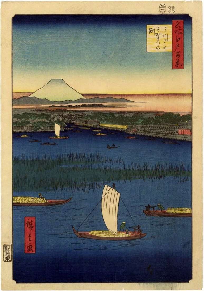
Not far from the Mannenbasi Bridge, in the lower reaches of the Sumidagawa River, the Hakozakagawa Channel separated from its main channel. At the intersection of the two arms of
Earlier than Shin-Fuji, Hiroshige showed it in the previous sheet, was built by Moto-Fuji – the original Fuji. The appearance of such structures can also be explained by the difficulties
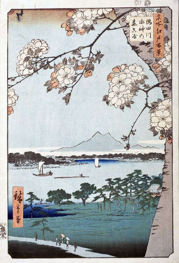
On the island of Mukojima, on the left bank of the Sumidagawa River, there was a Shinto-no Mori Shinto shrine in the forest, dedicated to the Sumidagawa River. The main
At the foot of the Sannodait hill, on the shore of a long pond similar to a pumpkin, is the temple of Hiyoshi Sanno Gonggen. Previously, it was a natural
The area adjacent to the Shinto shrine of Massaki Inari-medzin jinja was called Massaki. The temple of Massaki Inari, better known than the other Inari temples in Edo. On the
Rakandzi’s temple belonged to Obak-shu, one of the directions of Zen Buddhism, which came from China in the 17th century. He was among the rice fields between the rivers Tategava
Hiroshige does not depict the monastery of Mokubodzi, although he is declared in the name of the leaf. The area of Godzensaikhat is only visible on the horizon. The main
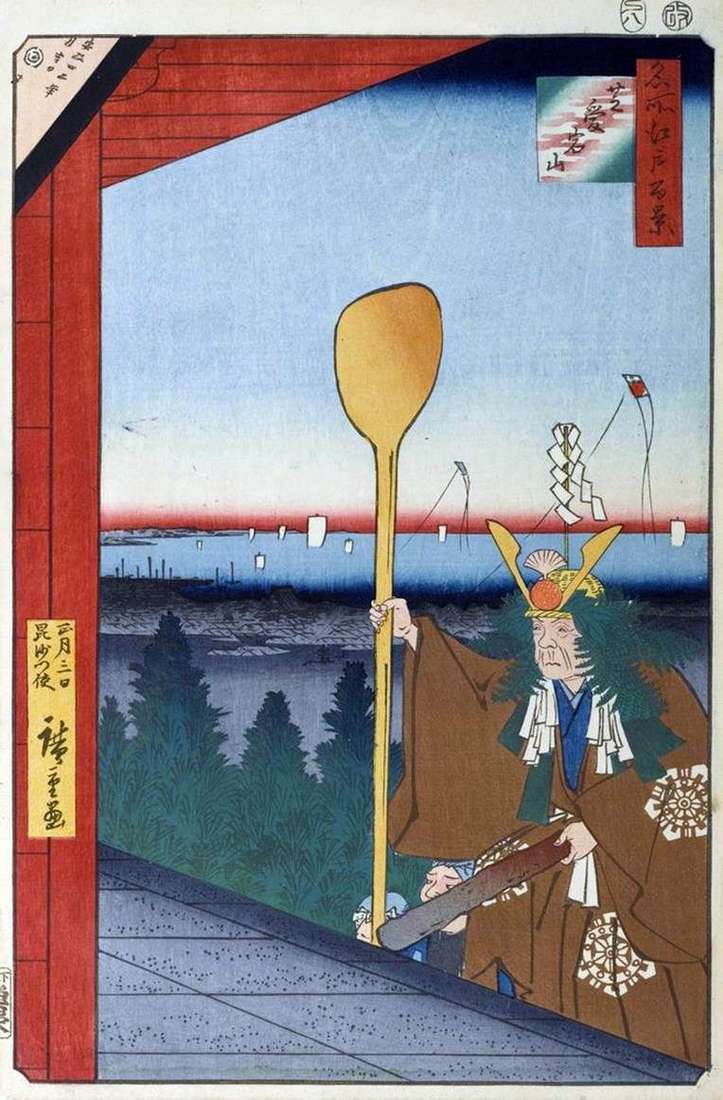
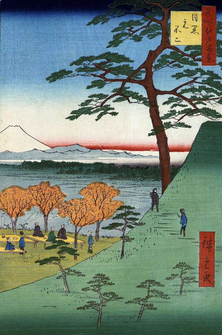
Mount Atagoyama was in the east of the city of Edo in the Yamanote district, where the daimyo mansions and high-ranking samurai Edo were located. Hiroshige portrayed the view from
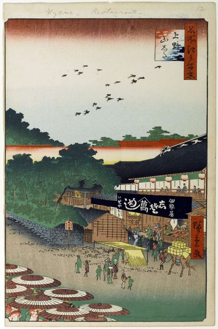
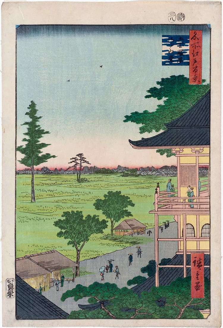
The locality, called Yamashita, was at the eastern slope of Mount Ueno. The area of Wenoyamasita was originally constructed to prevent a fire. The engraving depicts a road between the
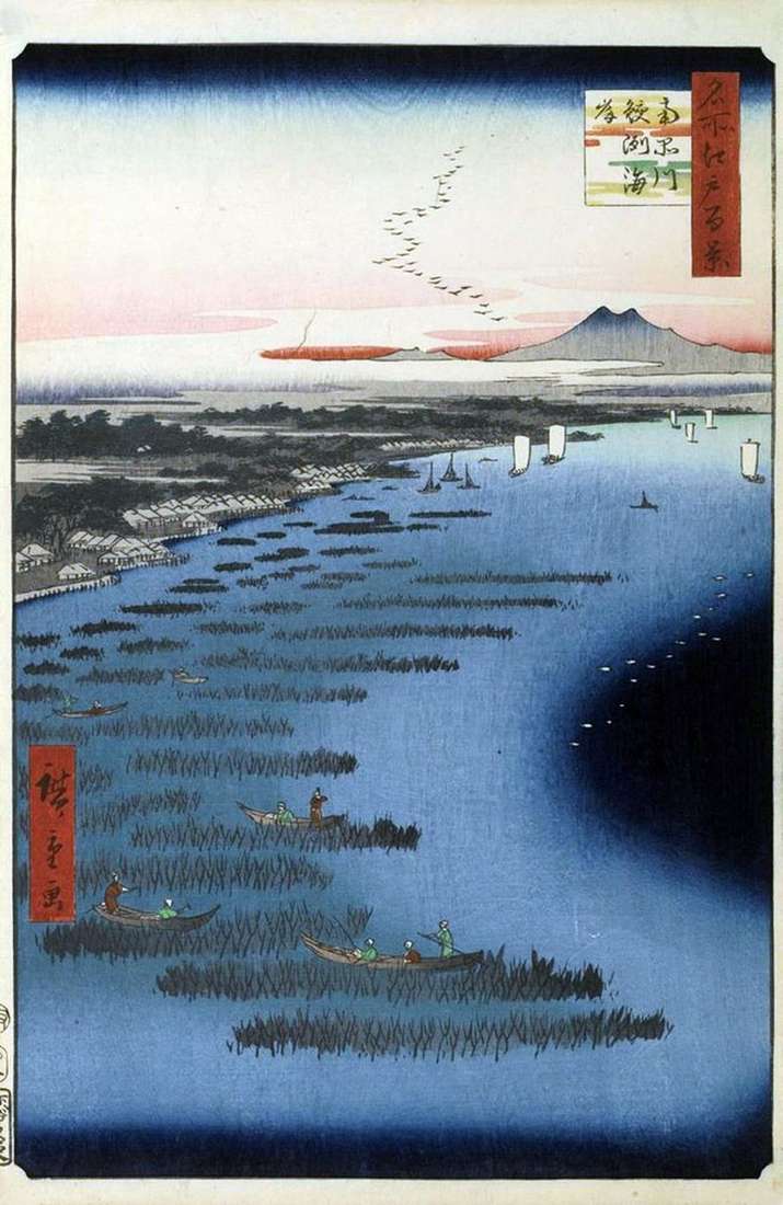
Before the spectator unfolds a wide panorama of the Edo Gulf from Sinagawa station to the mouth of the Takikawa River, visible from a bird’s eye view, with the exception
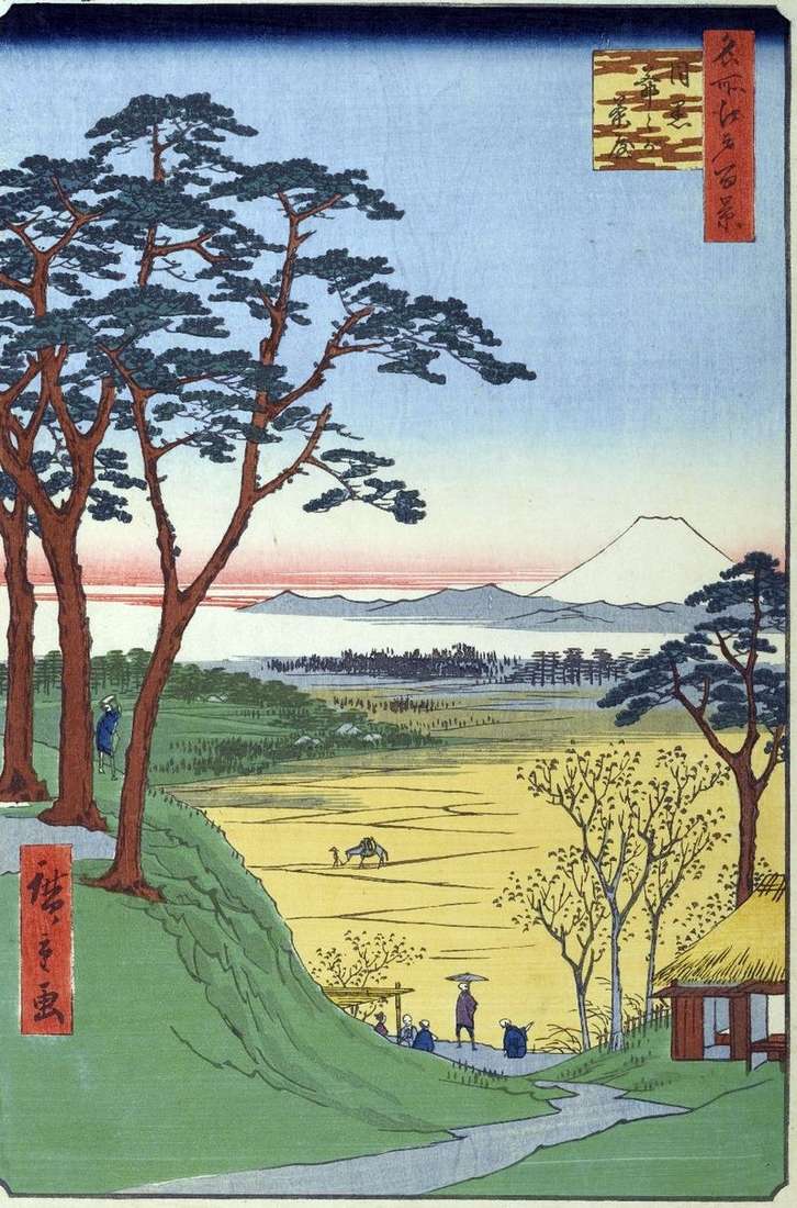
From the elevation, passing along the Megurogawa, a view of the rice fields and Mount Fuji was opened. Here was a famous temple dedicated to Fudo-Meo. The area of Meguro
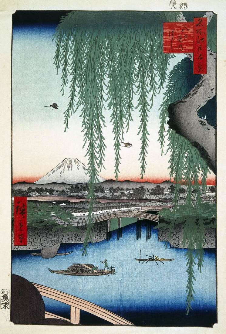
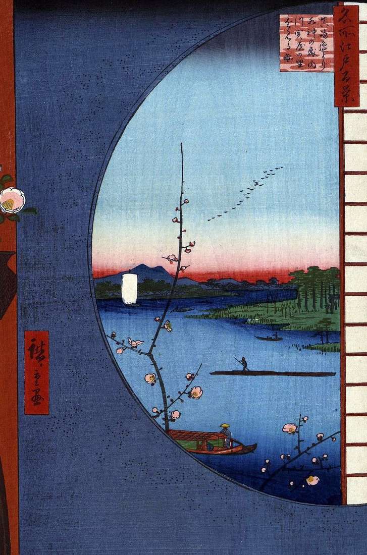
The Yatsumi-no hasi bridge is translated as “The Bridge of Eight Kinds,” the figure eight denotes the multiplicity of something, which means that species can be opened in any direction.
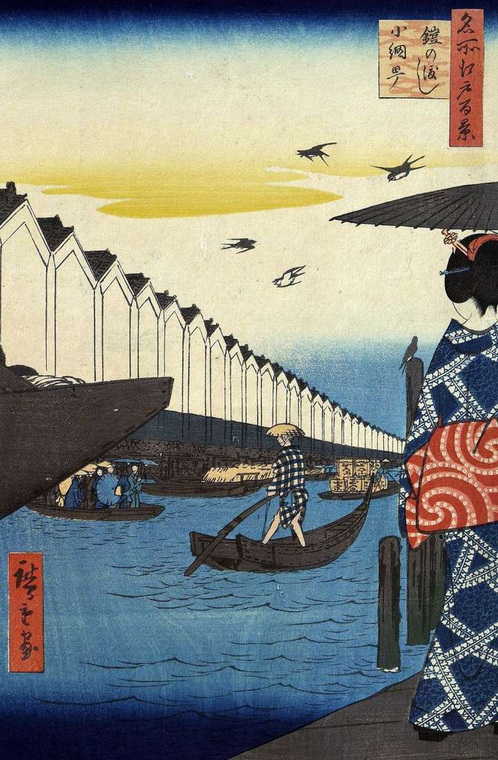
Hiroshige shows a view of the Nihonbasigawa River, which opens from the Kayabate quarter, which means “Miscant warehouses”. Here were shops of merchants who traded a miscant-reed, they were covered
The area in the Minato area near the mountain of Atagoyama was one of the most aristocratic districts of Edo, where the daimyo mansions and houses of noble samurais were
In this area, the Sumidagawa River was called Asakusagawa. Behind the gates of Asakusa Gomon were the government rice warehouses of Asakusa Gozo. Warehouses were located on eight berths, as
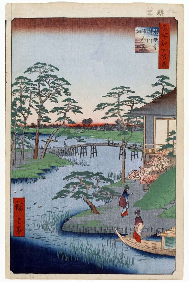
Next to the shrine of Tomiok Hatimangu, more precisely, to the right of it, was the Buddhist temple of Battoji Eitayidzi, who was famous for his garden. The territory of