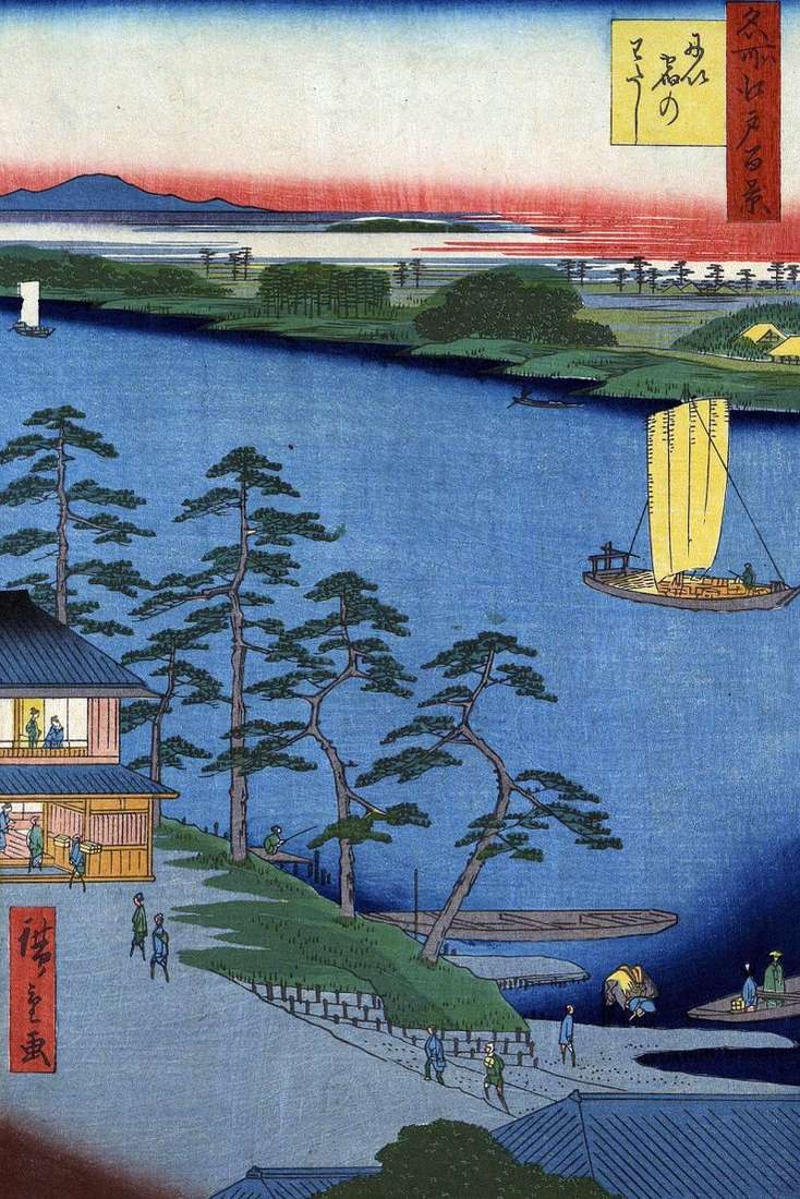
Nippori was located between Yanaka and Dokanyama in the northwest of the Ueno and Asukayama mountains. In the east, there were cliffs, from which a beautiful view of the rice
Nippori was located between Yanaka and Dokanyama in the northwest of the Ueno and Asukayama mountains. In the east, there were cliffs, from which a beautiful view of the rice
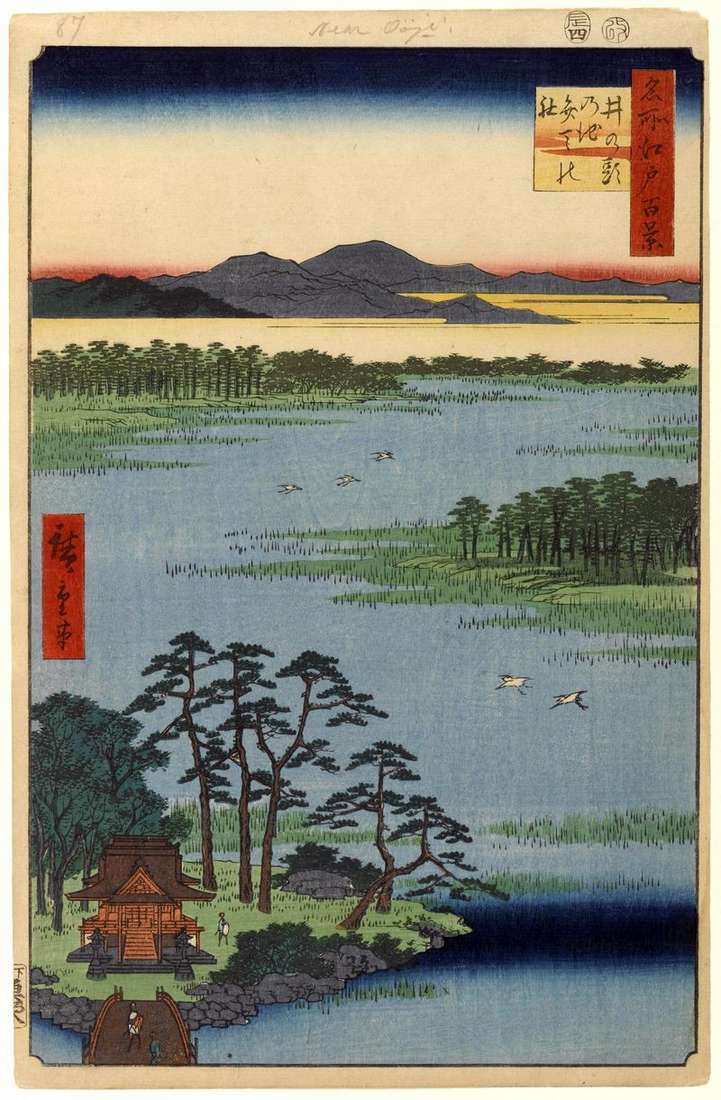
The pond of Inokasira was in the Musashi-no area, where there were many springs. This area is significantly removed from the center of Edo, it is difficult to call it
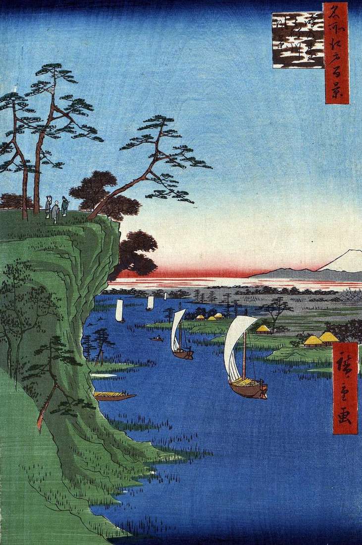
The terrain depicted by Hiroshige was adjacent to the eastern bank of the Sumidagawa River, which flowed into the Edovan Gulf. In the north of the Khondze district, there were
The Sumidagawa River flows east from the Shanjiu Ohashi Bridge, and then turns south, where Ayasegawa flows into it. It is this section of the river that opens to the
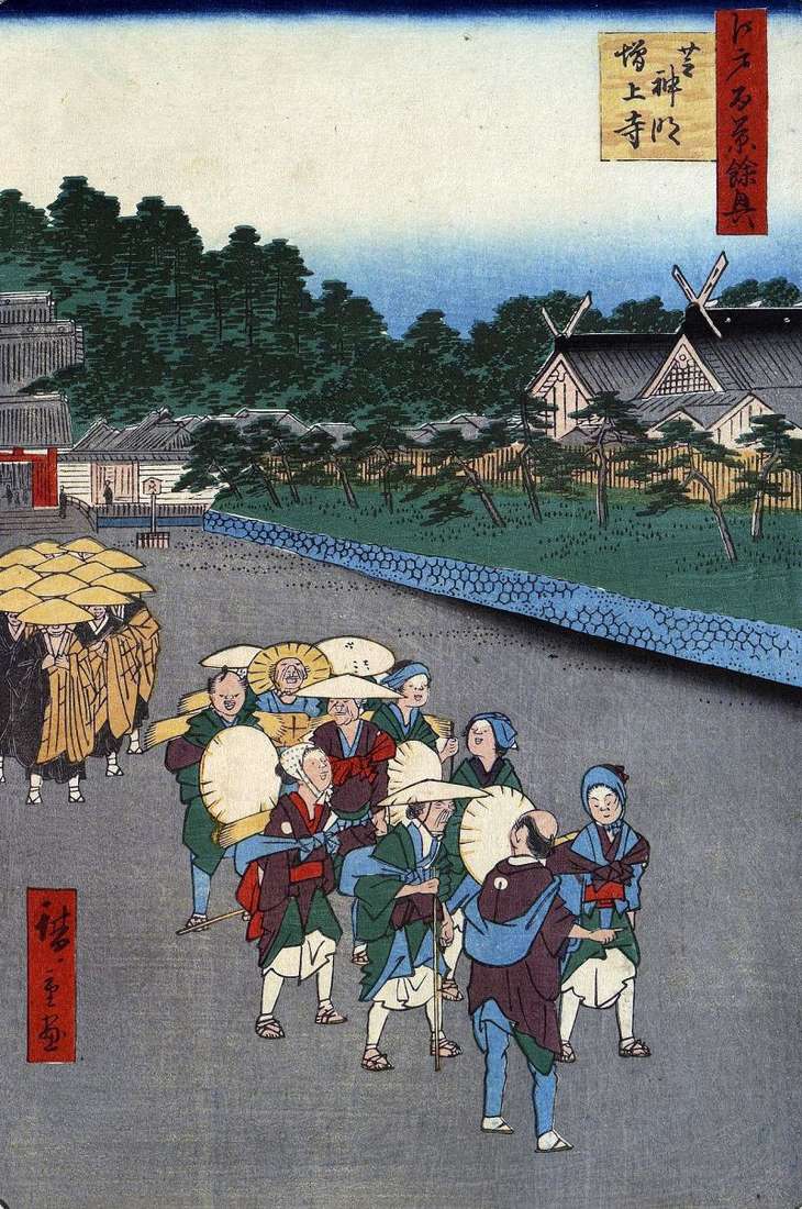
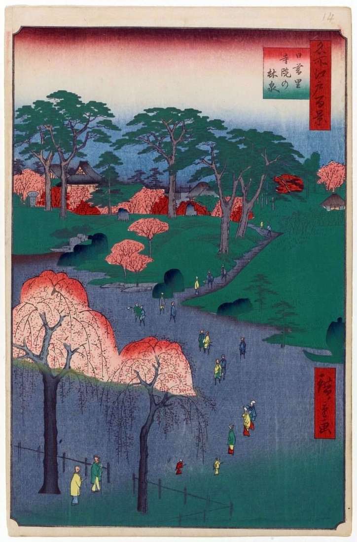
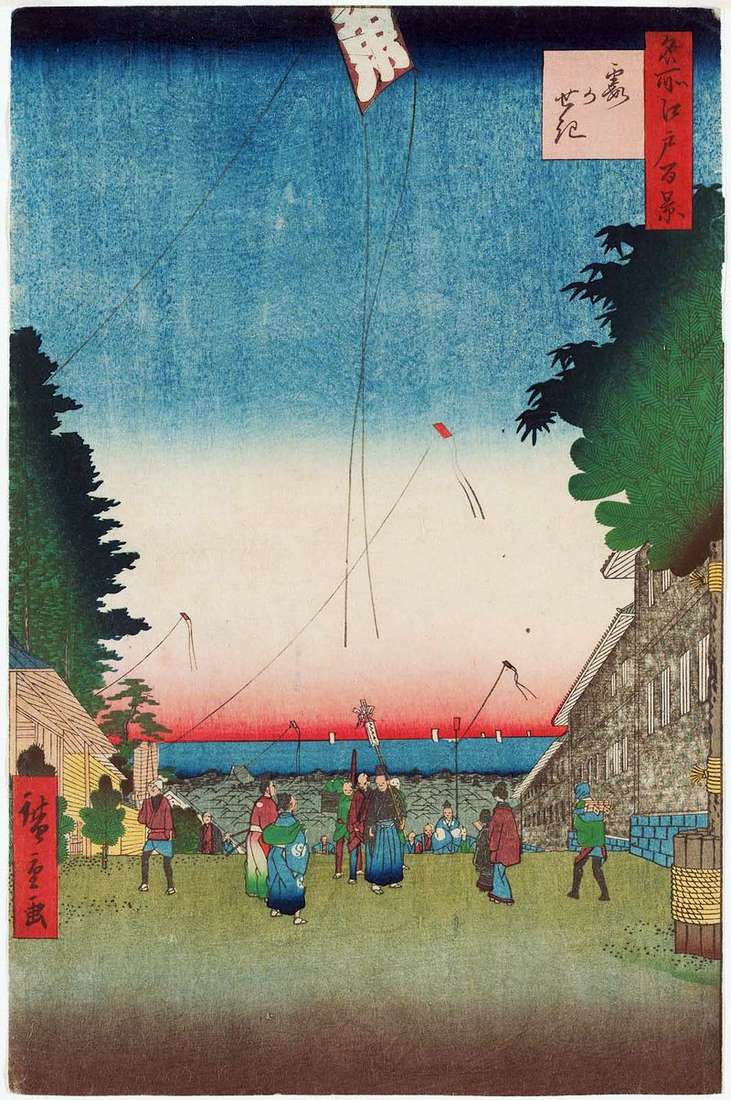
The Dzojedzi Monastery on Mount Sanengzang was the main temple in the Kanto area of the Jedo-shu school. Hiroshige depicts the square in front of the red gates of Dimon
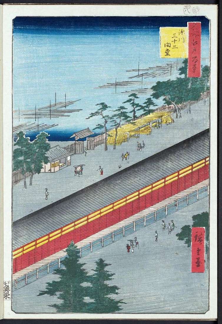
Sanjusangendo – The Temple of Thirty-Three Kahn. Ken is a measure of length equal to 1.80 m. Between the pillars of the gallery of this temple there were thirty-three spans
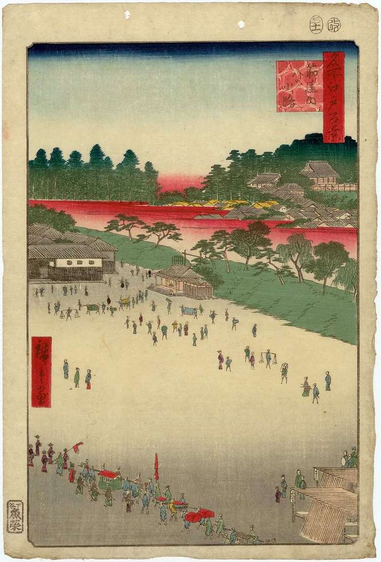
The Quarter of Odemmate was the first road station on the Osjukaido road. In 1594, after the construction of the bridge of Senzujoshi, the need for Odemmata fell away. Here
On the outskirts of the Sibatamati quarter, at the gate of Takanava, there used to be an outpost checking luggage for people going to Edo and Edo. Because of the
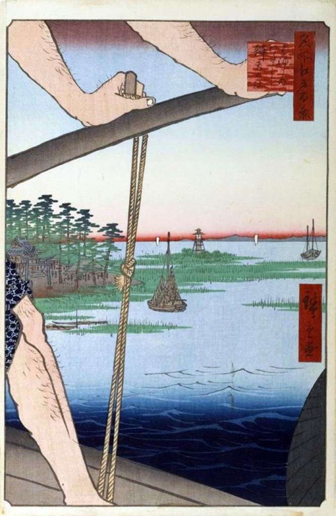
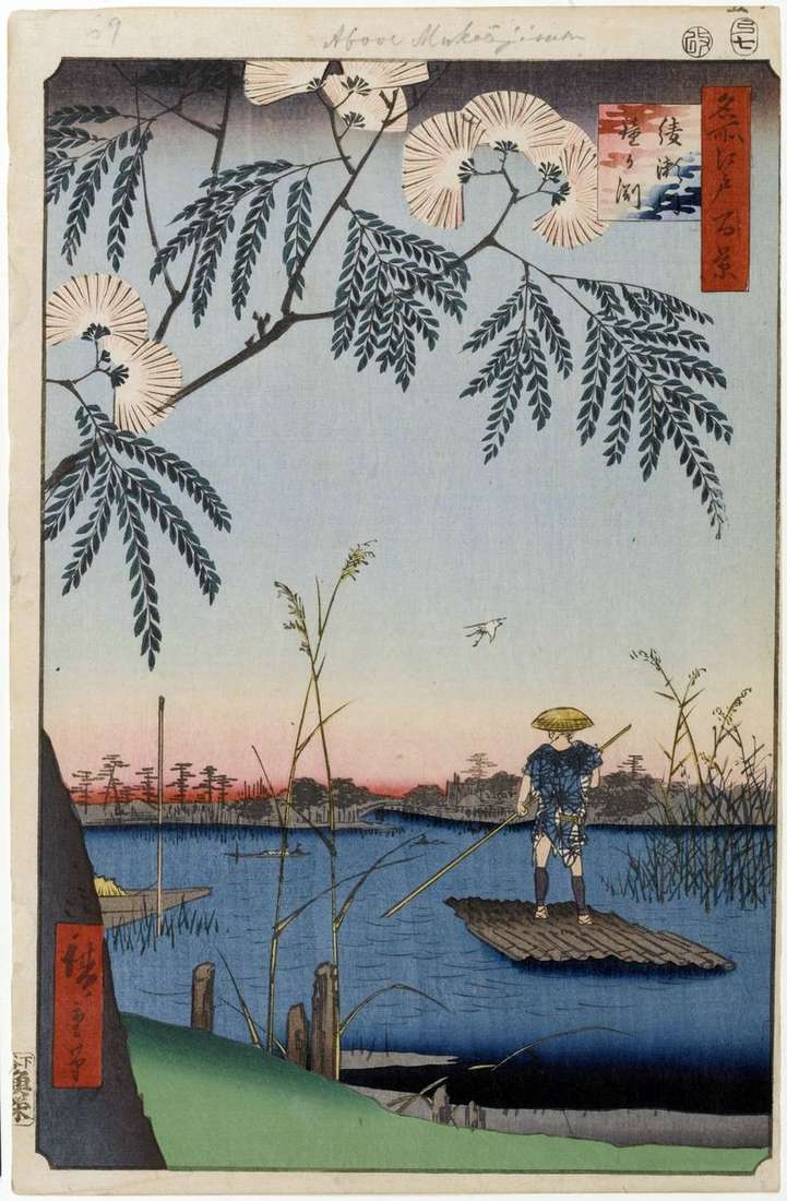
In this engraving, Hiroshige uses the same method of contrasting contrasting plans, sharply pushing the feet and hands of the boatman to the forefront. Hiroshige chooses the most characteristic motive
The monastery Kinryudzan – the Mountain of the Golden Dragon – is known in another reading as Asakusa-dera. The five-story pagoda and the massive hondo building, painted in red, are
In 1646, the monk of Otorii Nobusuke cut out the image of Sugawara no Mitizane, from the sacred tree of the quinai plum and built a chapel in which he
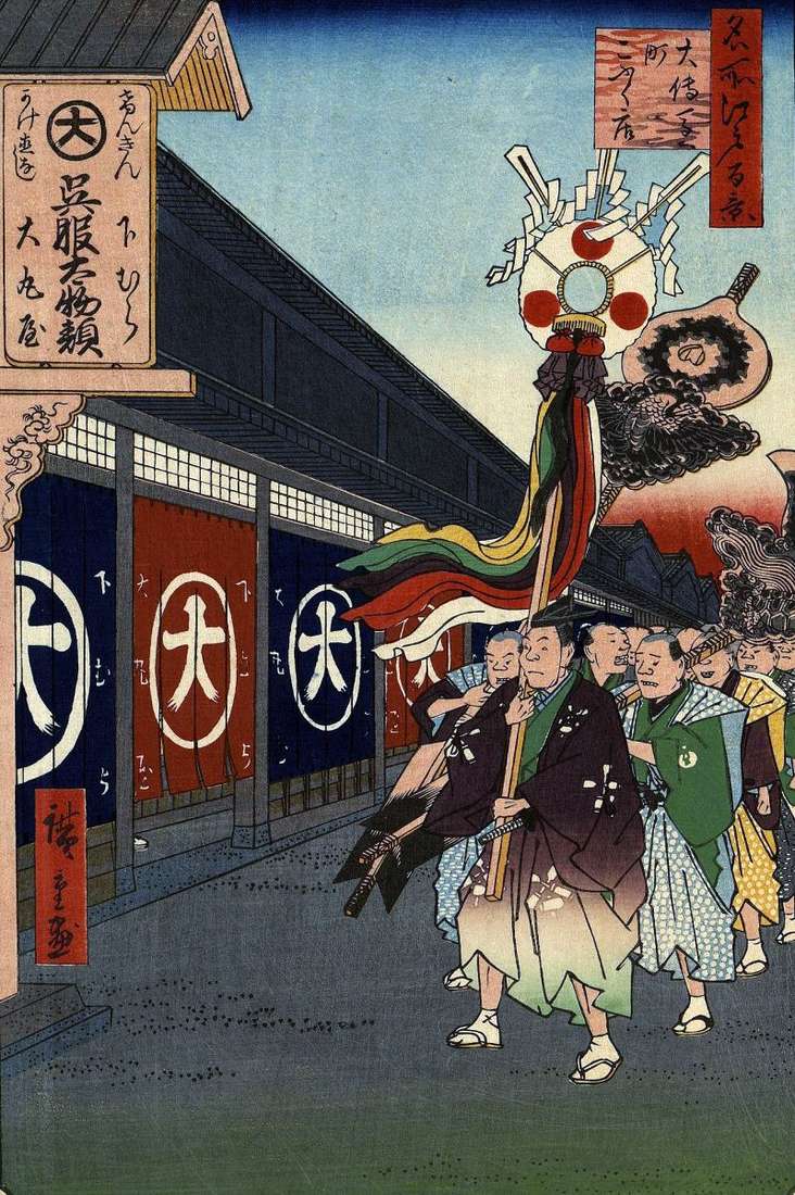
At the beginning of the Edo period, a quarter of artisans was formed in the Kanda area near the merchants’ quarter. They shared by occupation, each quarter was called the

The village of Minova was located south of the Senju station along the Osyukaydo tract and was formerly called Haradzyukuta. Before the construction of the Shanjiu Ohashi Bridge, there was
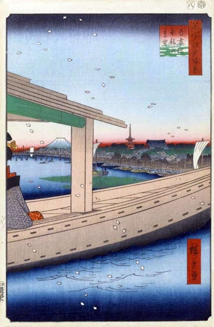
In this series, Hiroshige often portrays crossings over rivers and canals, but does not often show their piers. Crossings played a big role as a means of communication between different
From the Kasumigaseki Upland – Mist of Mists, a beautiful view of the Bay of Edovan with whitening sails against the background of the morning sky. The outpost was built
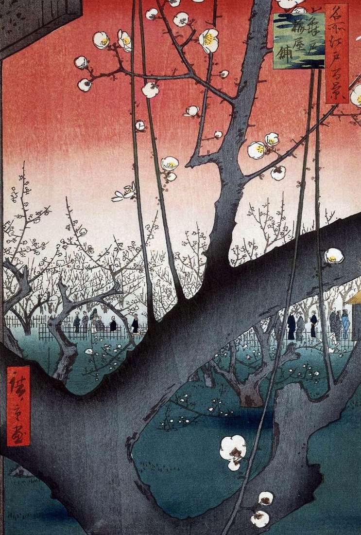
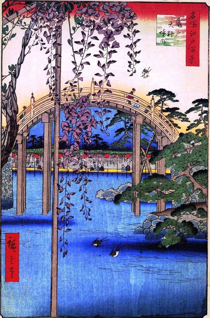
To the northeast of the Sanctuary of Kamaydo-tenzin, which is also known as the Yoshima-tenzin temple in Edo, was Seykean’s famous plum mansion and the famous plum garden – Kameydo
Hill Konodai is located on the western edge of the hill of Simosudaiti. At the foot of the hill, from the north to the south flowed the river Tonegava. Earlier
Until 1841, the buildings of the Kabuki Theater were located in the Ginza quarter. In 1841, a fire broke out, all the buildings of the theater burned and part of
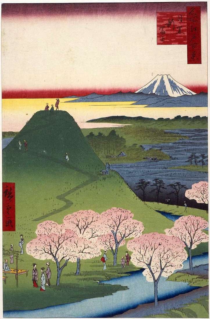
In the area of Meguro were created two artificial mountains associated with the cult of Fuji. Pilgrimages for the worship of the deity Fuji-gongen began in the 9th century, during
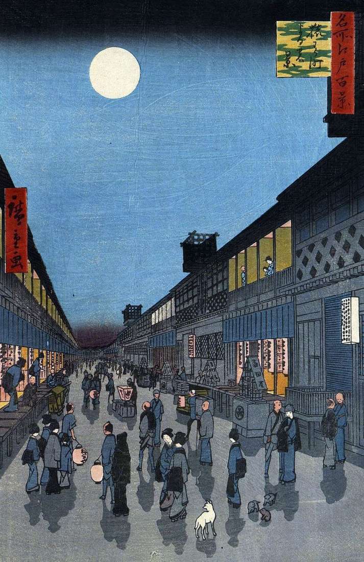
Behind the gates of Sudzitigaimon was a square that served to prevent a fire. From her departed eight roads, hence the name – Yatsukoji: “Eight streets.” In Japan, often used
In the foreground is the shore of the Yamashita Quarter, inhabited by merchants and artisans. On the other side of the canal in the Sakurada area was the Hibiya area