The Shinto shrine of Suamemedzin was built at 1205, it was considered the guardian of two adjoining areas – Janaka and Nippori. From it opened a magnificent view of the
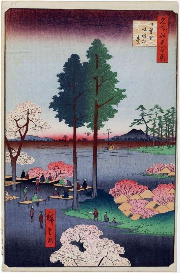
The Shinto shrine of Suamemedzin was built at 1205, it was considered the guardian of two adjoining areas – Janaka and Nippori. From it opened a magnificent view of the
The area depicted by Hiroshige is not very large, although it is located in the center of Edo, near the castle of the shogun. On the right is a mound,
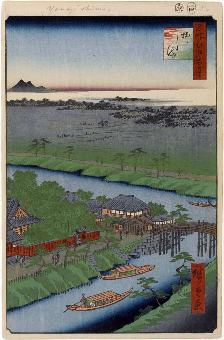
Hiroshige shows the intersection of two canals, which play an important role in the unified system of rivers and canals of Edo, connecting with the main artery of the Eastern
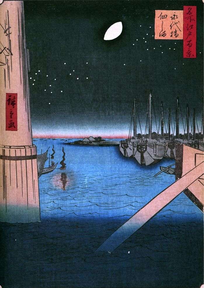
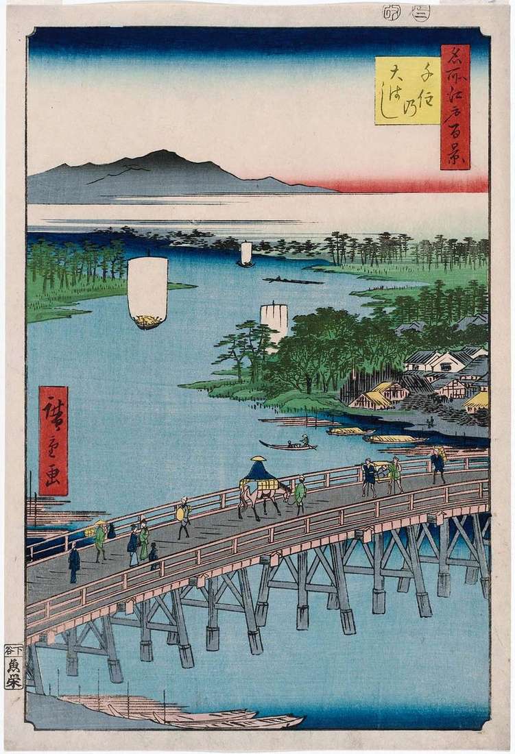
Bridge Eitaybashi, built in 1698, was located in the lower reaches of the Sumidagawa River, between Hakozaki and Sagate. The island of Tsukudajima, visible on the horizon, was inundated. It
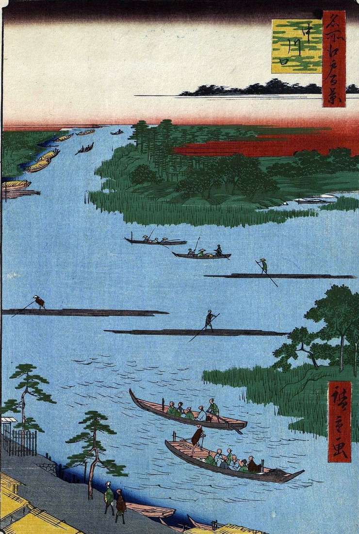
Hiroshige depicts the junction point of the three important Edo transport rivers, it is Nakagawa, Onagigawa and Sinkava. The Nakagawa River, an offshoot of the Tonegawa River, flowed into the
Previously, the Senju district was located on the northern shore of Arakawa, which was the upper reaches of the Sumidagawa River. The quarter was named so, because in this area
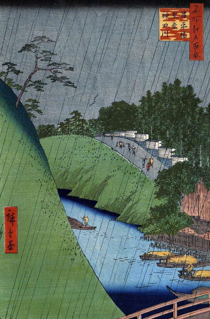
Hiroshige depicted the river Kandagawa, originating in the Musashi area and flowing into the Sumida-gawa river. Steep slopes, between which the river flowed, were artificial. They were built in order
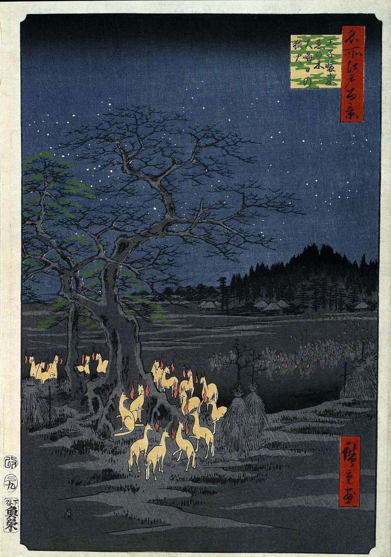
The engraving is different from the rest of the series, it is fantastic, completely unreal and mysterious, although the place depicted in it is quite specific. These are the Sedzoku
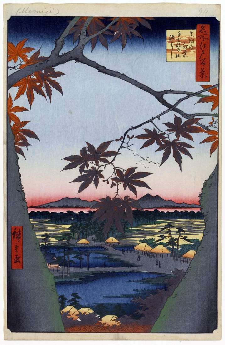
Between the trunks of the large maple tree with red leaves pushed to the fore, a view of the Mama locality opens. This huge maple was known to the inhabitants
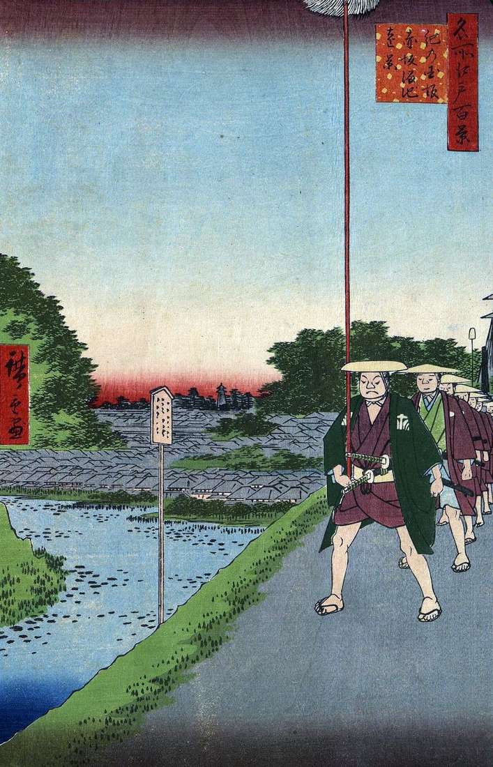
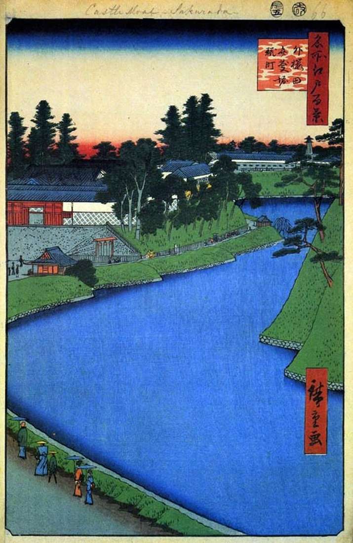
The engraving depicts a procession of samurai that moves along Sotobori – the Outer ditch surrounding the castle of the shogun. This was one of the grandiose events of Tokugawa
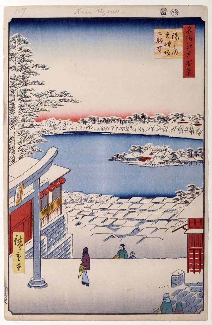
In front of the spectator a winter landscape opens with a view of the pond Sinobadzu no Ike. In the heart of the pond on the island was the sanctuary
The name “Bakurote” comes from the name of the horse traders – Bakuro and means “Feeding the horses”. Bakurote was the starting point of the Osjukai-do tract. Here was the
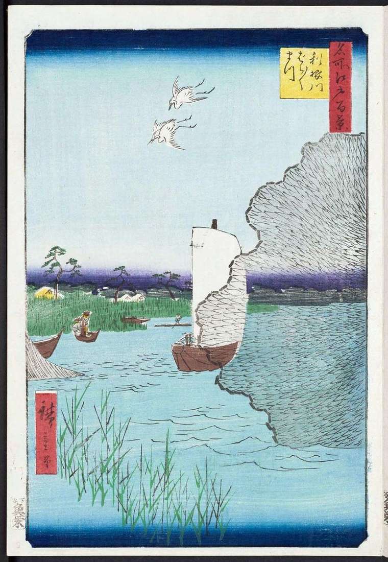
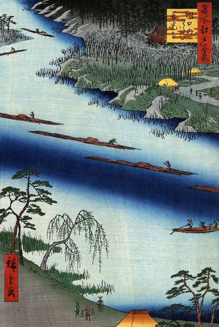
Edo was a unique city, dense urban buildings adjoining it with rice paddies, orchards, parks of temples and sanctuaries. The Tonegawa River was famous in the Edo period for its
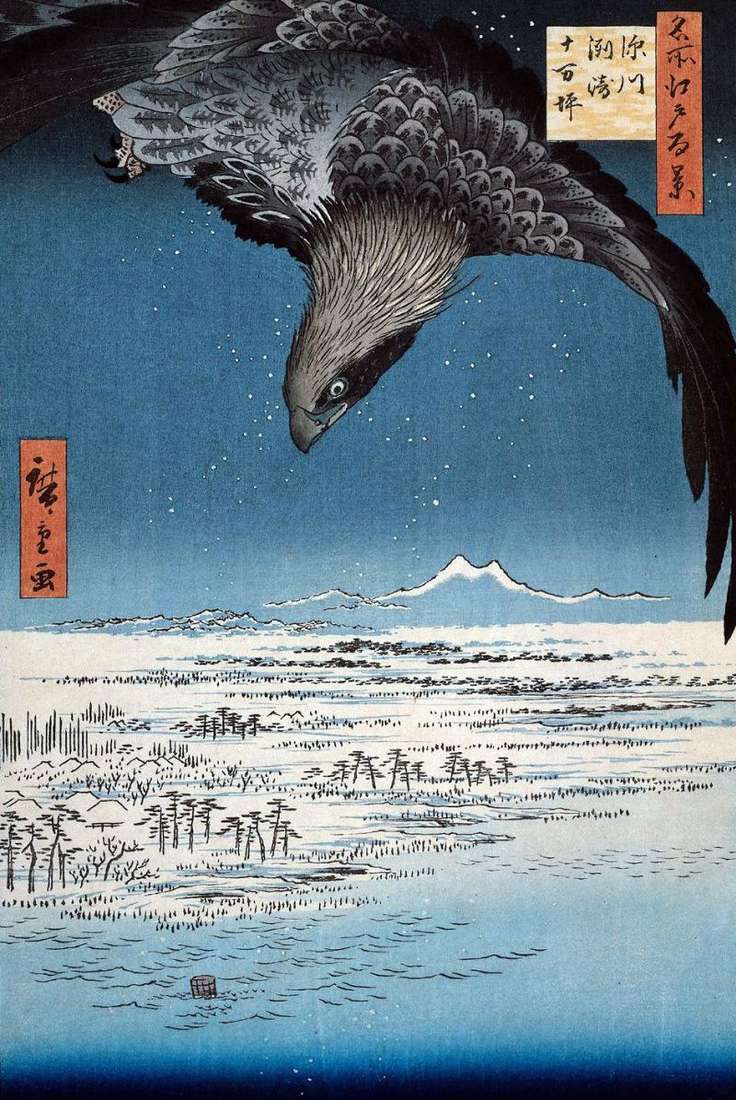
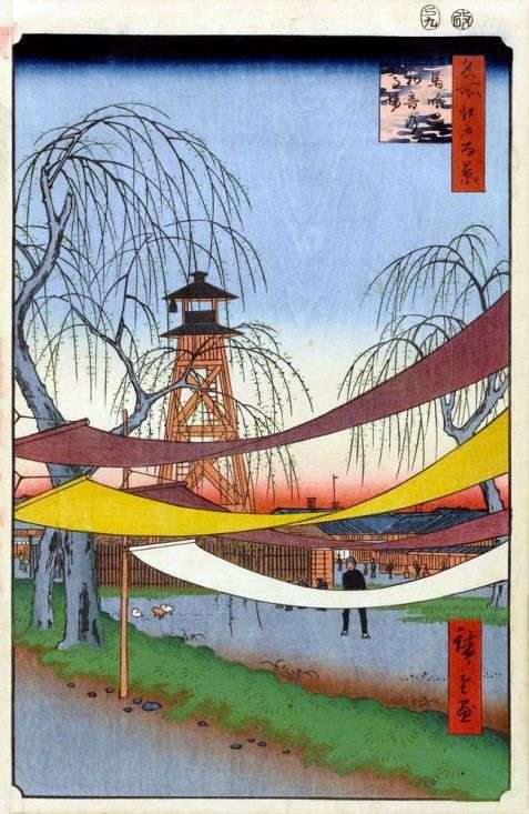
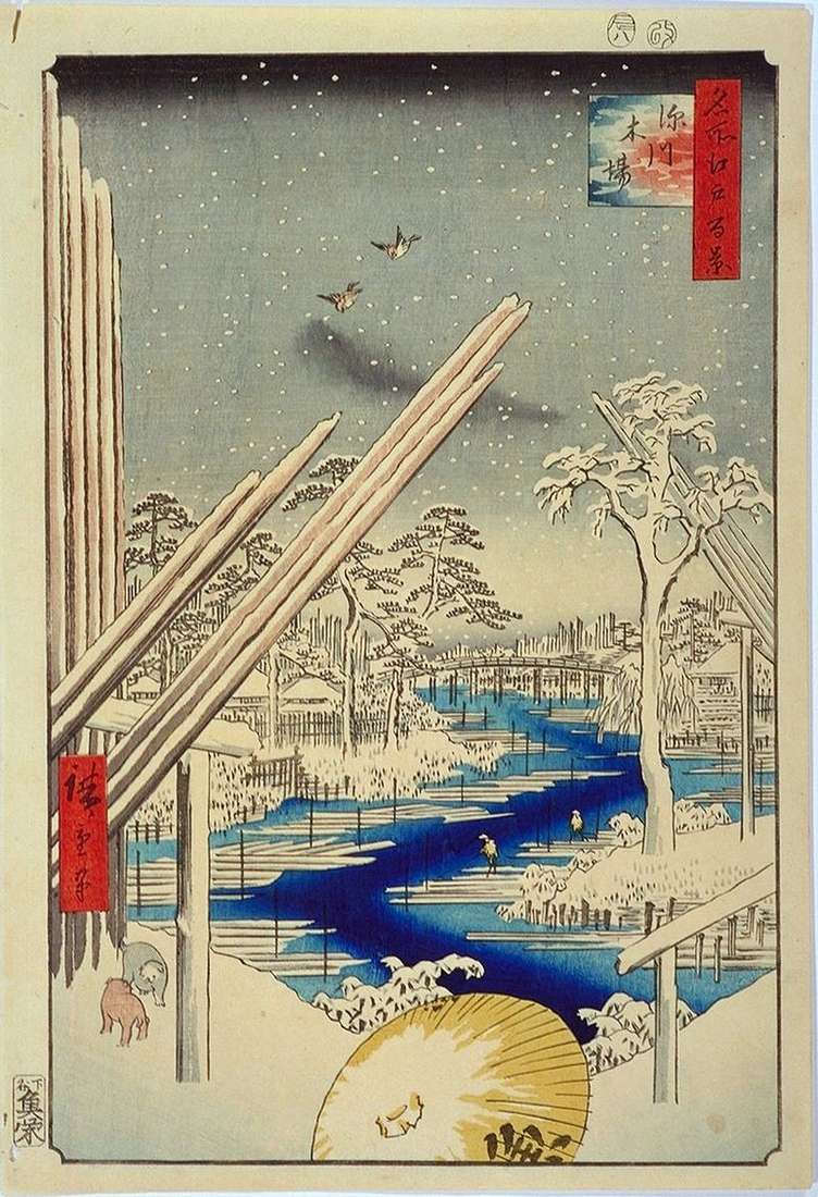
The engraving offers a view of the snow-covered expanses of the Dzyumantsubo area, which means – One Hundred Thousand Tsubo. Earlier, here, on the left bank of the Sumidagawa River,
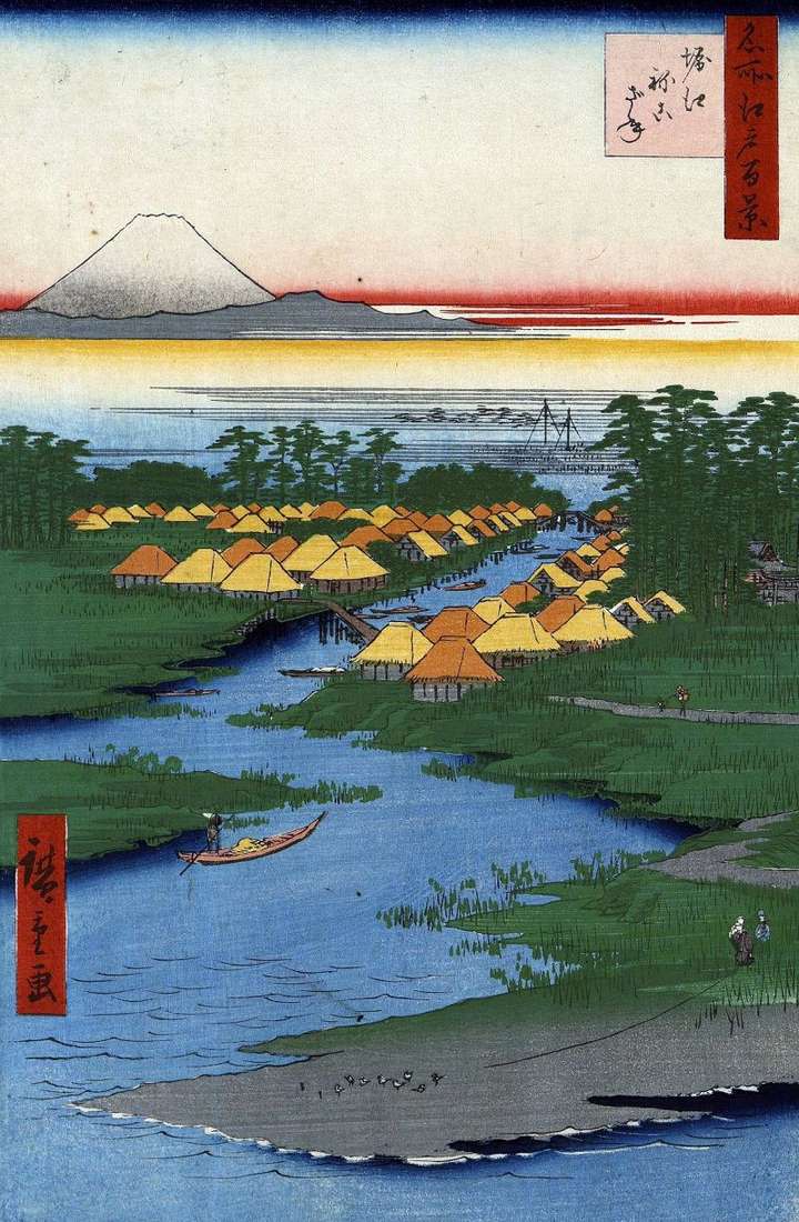
In the area of Getoku, which was the center of the supply of Edo with salt, there were three villages: Horye, Nekozane, Todaidzyma. On the banks of the Sakaigava River,
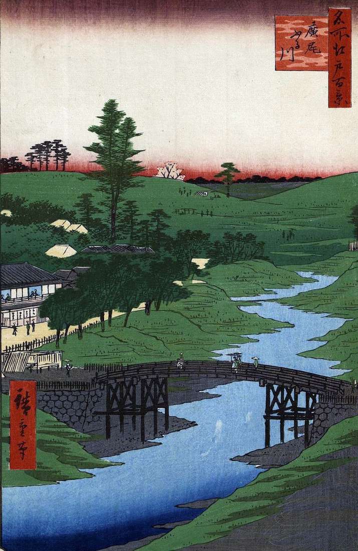
To the south-west of Edo was the plain of Hiro-ha hara, which for a long time remained uninhabited. At the end of the Edo period, the townspeople began to flock
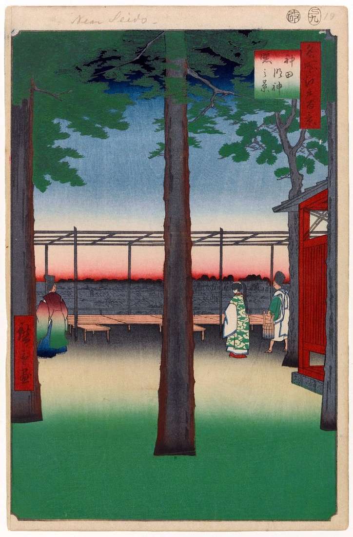
Before the founding of the military government in Edo, the Kandamejin Temple was located at the Tyra no Masakado Mound near the Kandabashi Gates, but as the castle grew larger,
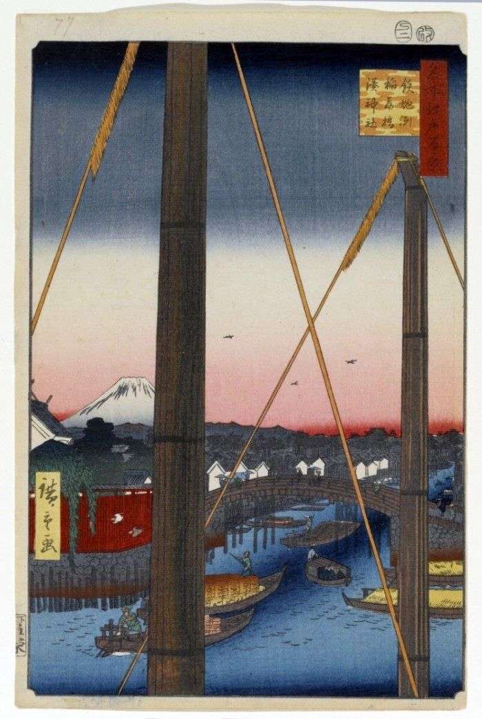
In the foreground, Hiroshige portrayed the masts of two merchant ships through which the Inaribasi Bridge and the Hattebori Canal are visible. A large number of artificial canals were explained
Monastery Zenkoji of the Tendai school was located in a place called Kawaguchi. It was a branch of the sanctuary, built almost 1400 years ago in Nagano Prefecture, also called
Houses in Edo were wooden, so they often burned. After major fires, there was a need for a forest to restore burnt houses. After the formation of the government of
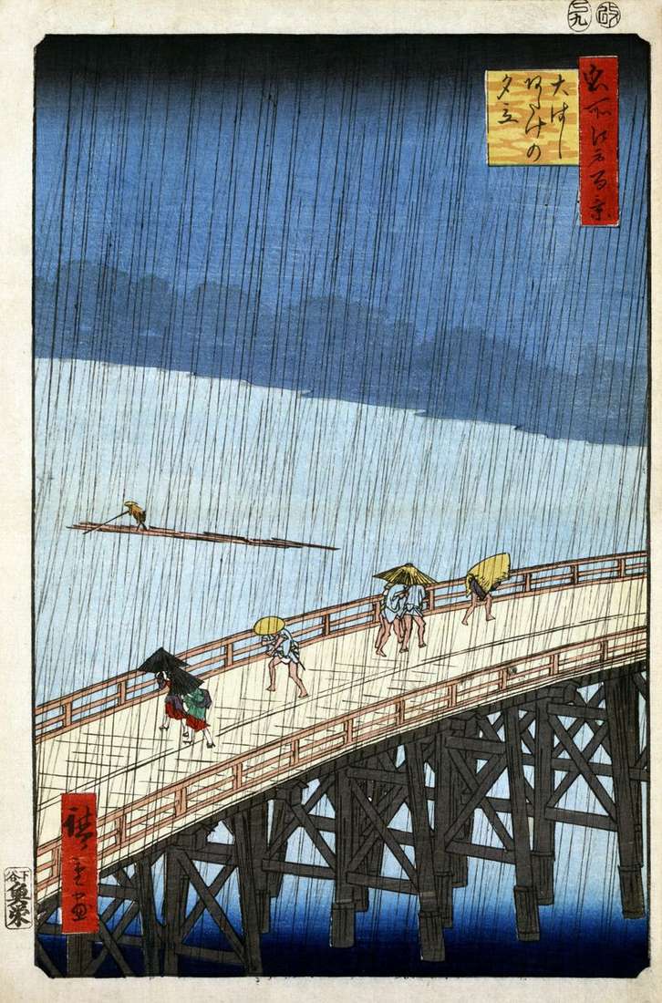
Hiroshige depicts in this engraving the bridge “Sin-Ohashi”, which means “The New Great Bridge”. The Ohashi Bridge was built on the Sumidagawa River, it was not far from the Regokubasi